
Case Number: 26MST009
Manager: Robert Prosak
Director, IP & Licensing
S&T Technology Transfer & Economic Development
robert.prosak@mst.edu
PDF Download: OGLe-Mine: Obstacle-infused Goalconditioned Learning Marketing Slick
Publication: OGLe-Mine: Obstacle-infused Goal-conditioned Learning Publication
Opportunity
Seeking a licensing and development to advance the technology towards mining operations
Problem Statement
Underground mining is one of the most dangerous occupations in the world. When a disaster strikes, miners must navigate to safety through dark, debris-filled tunnels where pre-planned routes may no longer exist. Traditional communication systems, such as leaky feeder networks, fail under exactly
these conditions. Existing navigation and path-planning methods either require excessive computational power for low-power devices or treat every obstacle as impassable, forcing miners onto unnecessarily long detours.
Solution
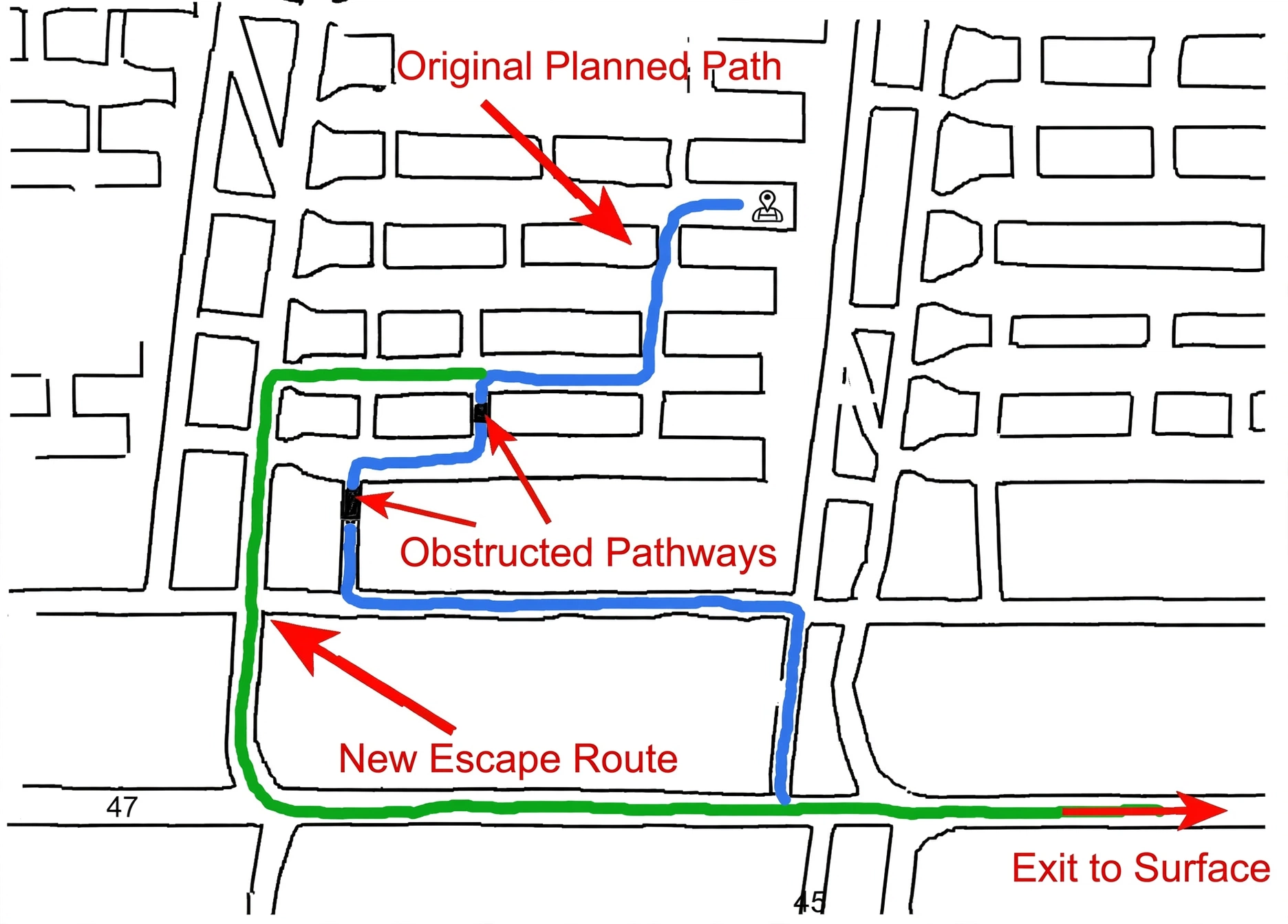
Researchers at Missouri University of Science and Technology have developed OGLe-Mine, an AI navigation framework that guides miners to the nearest exit in real time after a disaster. The system runs on standard mobile devices via a Delay Tolerant Network and continuously updates a pre-disaster mine map using onboard sensors and miner input. A comparative learning model is trained
to distinguish passable obstacles, such as light smoke or small debris, from impassable obstacles, such as gas leaks or large boulders. A goal-conditioned reinforcement learning engine then uses these representations to predict the fastest possible path to an exit. In single agent tests OGLe-Mine outperformed competing methods by 4-5% in escape success rate and 10-15% in path efficiency. In multi-agent situations where miners share annotated maps over the network, gains ranged from 10 to 20% in escape time and up to 25% in path optimality.
Value Proposition
OGLe-Mine is lightweight enough to run on a mobile phone and is designed for the worst-case conditions a miner will ever face. It replaces static evacuation plans with a live, adaptive navigation system that improves as more miners share their observations. The framework is also applicable to post-disaster evacuation in large buildings and other GPS-denied environments.
Development Stage
Validated in simulation across mine maps up to 4 km² with single and multi-agent scenarios.
Intellectual Property
Provisional Patent Application Status: Filed
Inventors
Abhay Goyal , Sanjay Madria and Samuel Frimpong
Follow Technology Transfer and Economic Development